
IMAGES WANTED!
We are always on the lookout for new images to help us build up a picture of how the area looked in years gone by. So far, we have discovered very little photographic evidence and keen to build on the collection.
Donations and scans of images, sketches and photographs are all gratefully received.
We are always on the lookout for new images to help us build up a picture of how the area looked in years gone by. So far, we have discovered very little photographic evidence and keen to build on the collection.
Donations and scans of images, sketches and photographs are all gratefully received.
Maps
 Click the image to zoom in.
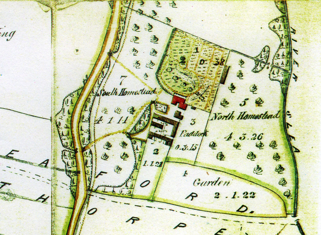
1849 estate map - Possibly from the Bristol Estates, detail showing the area surrounding Old Place. Note that the map is orientated west, with North to the right.
Old Place can be clearly seen in the centre of the map, with the coloured garden area adjoining above.
Behind the main house stand stable blocks and coachhouse, now restored and converted to dwellings.
Note the original course of Boston Road on the left, with Mareham Lane leading across the bottom towards the bridge / ford over the Old River Slea towards Cogglesford Mill.
 Click the image to zoom in.
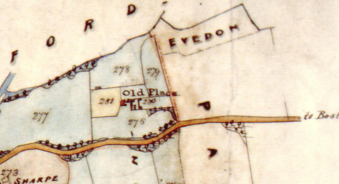
1861 Bristol Estates map - Now orientated North, although this map shows less detail than the earlier image, the south west of the drawing shows Charles Sharpe's nurseries (of Sharpe's Seeds fame). Sharpe also used land within the gardens at Old Place as a nursery, presumably rented from the Marquis of Bristol.
 Click the image to zoom in.
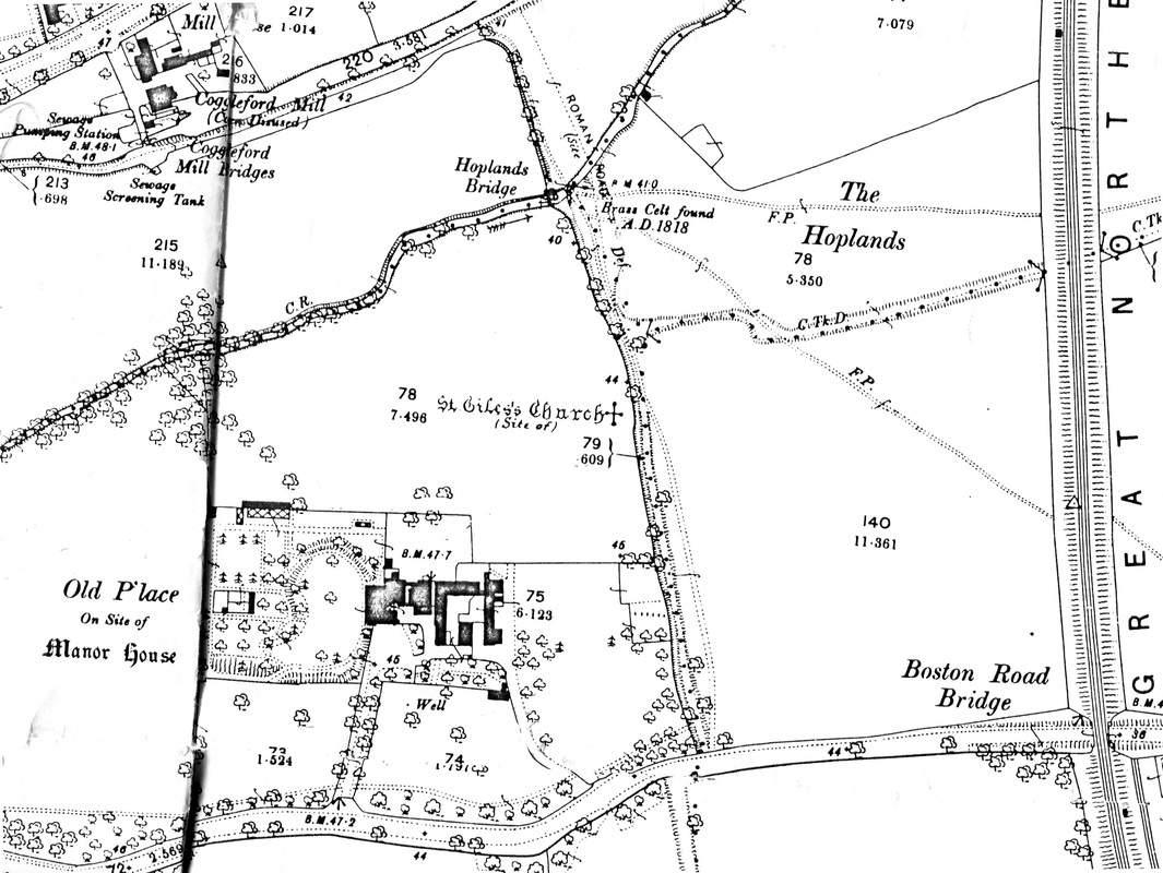
1887 Ordnance Survey map - With Victorian advances in map-making, the accuracy and level of detail improved significantly. The Great Northern Railway now straddles Boston Road; it's advent being the main contributing factor in the rapid decline of the Sleaford Navigation - Cogglesford Mill is now recorded as 'disused'.
The Victorian era also saw the start of recorded archaeological activity as this map perfectly illustrates. Not only does it mark the site of St Giles Church, but also the discovery of a 'Brass Celt' in 1818. That's almost 200 years of discoveries and there's still much, much more to find!
The Victorian era also saw the start of recorded archaeological activity as this map perfectly illustrates. Not only does it mark the site of St Giles Church, but also the discovery of a 'Brass Celt' in 1818. That's almost 200 years of discoveries and there's still much, much more to find!
Landmarks
 Click to zoom in.
Engraving of Old Place, poss. 18th century - taken from Trollope's 'Sleaford and the wapentakes of Flaxwell and Aswardhurn in the County of Lincoln'
This charming engraving represents Old Place as it probably stood in the early 1700s.
The lateral masonry of the the first floor can still be seen today in the stonework of the existing building below. The side windows and stepped gable are long gone, but it is quite likely that the trees illustrated to the right hand side of the building are the same English Yews that still stand to this day.
 Click to zoom in.
Pencil sketch of Old Place, c1805 - Nattes, John Claude (1765 - 1839)
This fantastically rare, probably unique image of the east prospect of Old Place shows how the building looked prior to major rebuilding in 1822 to add another storey and two domestic wings to the property, covering this wonderful historical hotch-potch of masonry forever.
Nattes was commissioned by Sir Joseph Banks to record the major buildings of Lincolnshire, resulting in over 700 individual works.
The crow-stepped gable, typically sixteenth century, can also be seen in the engraving above.
 Click to zoom in.
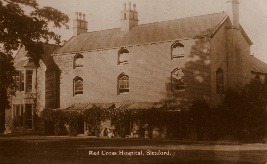
Postcard of Old Place, 1914-1918
Operating as a British Red Cross convalescence hospital during World War One.
Note the Red Cross nurse sitting outside.
Now this photo opens up a whole new can of worms! It appears that the house was covered in a brick facade over the top of the original stone work. When did this appear? Was it there when house was rebuilt? Added when the Victorian wing was fabricated? It sure doesn't exist now!
From the collection of Dr Wendy Atkin
 Click to zoom in.
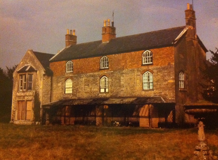
Colour photograph of Old Place, c1980 - dilapidated and boarded up prior to restoration and conversion to town houses in 1987-8.
Note the 19th century fountain in the foreground - sadly demolished by developers in 1988. The remains of the fountain were rediscovered in July 2013, of which very little now remains.
Note the 19th century fountain in the foreground - sadly demolished by developers in 1988. The remains of the fountain were rediscovered in July 2013, of which very little now remains.
 Click to zoom in.
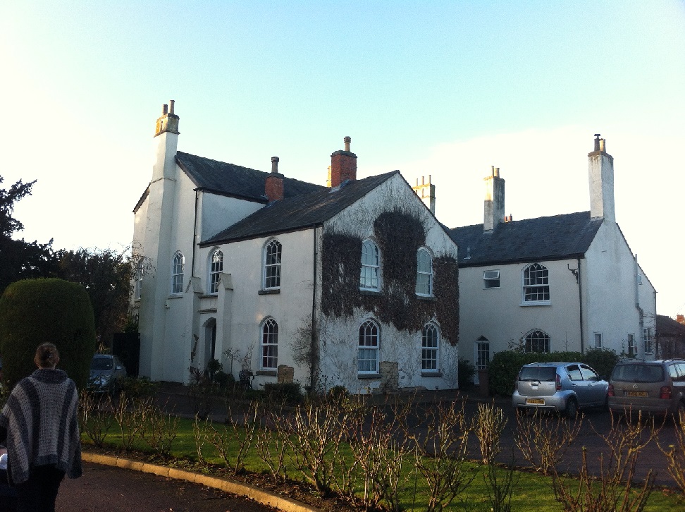
Colour photograph of Old Place, East prospect, December 2013
Taken from the same angle as the Nattes drawing above, difficult to believe it is the same building over 200 years later!
Taken from the same angle as the Nattes drawing above, difficult to believe it is the same building over 200 years later!
Videos
Brief video clip from 2007 providing evidence of mediaeval burials at St Giles church over the surface of the earlier Roman road (Mareham Lane) located in what is now St Giles Avenue, Sleaford.
| Excavation at St Giles Church / Mareham Lane - 2007 (Windows Media Video) |